
Essex County, Massachusetts
Plum Island Homes For Sale
MA
0 mi
Length of the barrier island
0 acres
Protected within Parker River National Wildlife Refuge
$1.1M–1.7M
Recent median sale price range, Newburyport-side Plum Island (Redfin, 2025–26)
0
Year the island was first divided among Newbury, Ipswich & Rowley
Location
Where Plum Island is Located
Live Listings
Homes For Sale in Plum Island, MA
Listing information is provided by the MLS. Information is deemed reliable but not guaranteed and should be independently verified. Listings displayed may be subject to prior sale or withdrawal.
A Local's Perspective
Plum Island: An 11-Mile Barrier Island Shared by Four Towns
Plum Island was never its own town. In 1649 the Massachusetts General Court divided the barrier island among three colonial settlements — granting roughly two-fifths to Newbury, two-fifths to Ipswich, and one-fifth to Rowley — a split that, with Newburyport's 1851 incorporation carving territory out of Newbury, still defines the island's ownership today across all four communities. A turnpike and bridge completed in 1807 first opened the island to regular travel, and after a series of 19th-century shipwrecks prompted the founding of one of the nation's first U.S. Life-Saving Stations in 1874, the island's character shifted from grazing land and salt-hay harvesting toward recreation.
The defining chapter of Plum Island's built environment came in the 1920s, when the Plum Island Beach Company bought up the Newbury section, laid out Northern Boulevard, ran in electricity, and sold off lots for summer cottages — the architectural DNA still visible in the shingled, close-set houses along Northern Boulevard, Reservation Terrace, and Old Point Road today. In 1941–42 the federal government established the Parker River National Wildlife Refuge over the island's southern two-thirds (about 4,700 acres), permanently protecting that stretch for the more than 300 bird species that pass through or nest there, including the federally threatened piping plover. Severe blizzards in 1978 and again in 2013 reshaped the dunes and left some homes structurally compromised, underscoring that this has always been a working barrier island, not a fixed piece of ground.
That tension between desirability and instability defines the market today. A 2015 Army Corps jetty repair altered sediment flow and accelerated erosion in places to roughly 53 feet a year according to a December 2025 WBUR report, and Massachusetts' new ResilientCoasts Initiative has begun funding voluntary FEMA buyouts — one Plum Island homeowner accepted a $1 million buyout in October 2025 rather than keep rebuilding. Yet scarcity keeps pushing prices up: Redfin's neighborhood data for the Newburyport side of Plum Island has shown median sale prices ranging roughly from $1.1 million to $1.7 million across recent 2025–2026 reporting windows, reflecting both a thin, seasonal sales sample and genuinely fierce demand for a limited, non-replicable inventory of oceanfront and marsh-front cottages.
At a Glance
- Municipal status
- Unincorporated barrier island — land is divided among Newburyport, Newbury, Rowley & Ipswich
- County
- Essex County, Massachusetts
- Island length
- Approximately 11 miles
- Protected land
- Parker River National Wildlife Refuge covers the southern two-thirds (4,700 acres)
- Mainland access
- Single causeway — the Plum Island Turnpike — connects the island to Newbury/Newburyport
Source-verified as of 2026-07-23.
Highlights
Why People Choose Plum Island

Parker River National Wildlife Refuge
A 4,700-acre federal refuge covering the island's southern two-thirds, with the Hellcat boardwalk trails, observation towers over the Bill Forward Pool, and habitat for over 300 recorded bird species including the piping plover.

Sandy Point State Reservation
At the island's southern tip in Ipswich — ocean-side and Plum Island Sound-side swimming, birding, and tidal flats, with parking, restrooms, and a boat launch.
_(48734934826).jpg%2F1280px-Plum_Island_Lighthouse_(1)_(48734934826).jpg&w=3840&q=75)
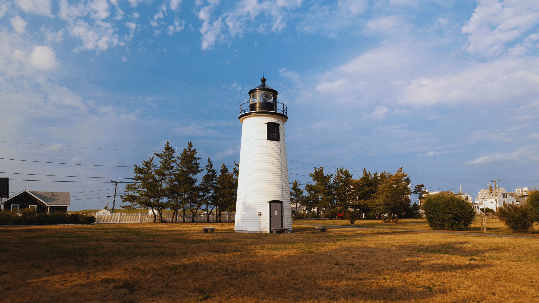
Plum Island Lighthouse
Marks the entrance to the Merrimack River at the island's northern end, one of the working aids to navigation tied to the island's 19th-century maritime history.
The Basin
A sheltered tidal harbor and marsh on the island's west side off Old Point Road, popular for kayaking, paddleboarding, and quieter waterfront living away from the open Atlantic.
Bob Lobster
A long-running seafood shack near the Plum Island Turnpike (opened 2001) that has become an island institution for summer visitors and residents alike.
Plum Island Beach's purple sand
At certain tides the beach reveals streaks of purple sand from garnet (pyrope) crystal deposits, a distinctive natural feature of the shoreline.
Neighborhoods
Plum Island's Neighborhoods & Villages

Northern Boulevard & Plum Island Center
The island's commercial hub and its most built-up oceanfront stretch — a mix of late-19th/early-20th-century summer cottages and post-war infill along numbered cross streets, laid out by the Plum Island Beach Company in the 1920s.
Reservation Terrace
Oceanfront homes on the island's east side, direct beach access, and some of the highest exposure to wind, salt, and coastal erosion.
Old Point Road / The Basin
West-side, marsh- and harbor-facing homes with calmer water, more bird life, and a tighter year-round neighborhood feel than the oceanfront blocks.
Sunset Drive / southern end near the Refuge
The quietest, least-developed residential section, bordering Parker River National Wildlife Refuge, prized for solitude and wildlife access, with seasonal shorebird-nesting closures nearby.
Lifestyle
Life in Plum Island
Life on Plum Island runs on tide charts and seasons more than a town calendar. It's a barrier-island rhythm: beach walks and birding in the shoulder seasons, a compressed but lively summer, and a quiet, storm-watching winter for the smaller number of year-round residents.
Parks & Recreation
Parks in Plum Island

Parker River National Wildlife Refuge
6 Plum Island Turnpike, Newburyport, MA
- Hellcat boardwalk trails
- Observation towers over Bill Forward Pool
- Visitor center
- ~6-mile Refuge Road
- Seasonal beach access (weather/nesting dependent)

Sandy Point State Reservation
Southern tip of Plum Island, Ipswich, MA
- Ocean and sound-side swimming
- Birding
- Boat launch
- Parking
- Restrooms
Plum Island Point Beach & Parking Lot
Northern Boulevard area, Newburyport, MA
- Public beach access
- Parking lot
- Managed by the Newburyport Harbormaster
Schools
Schools Serving Plum Island
Public Schools
Francis T. Bresnahan Elementary School (Newburyport section)
Elementary
Edward G. Molin Upper Elementary School (Newburyport section)
Upper Elementary
Rupert A. Nock Middle School (Newburyport section)
Middle
Newburyport High School (Newburyport section)
High
Newbury Elementary School (Newbury section)
Elementary
Pine Grove Elementary School (Rowley section)
Elementary
Triton Regional Middle School (Newbury & Rowley sections, shared with Salisbury)
Middle
Triton Regional High School (Newbury & Rowley sections, shared with Salisbury)
High
Paul F. Doyon Memorial School / Winthrop School (Ipswich section)
Elementary
Ipswich Middle School (Ipswich section)
Middle
Ipswich High School (Ipswich section)
High
Private Schools
The Governor's Academy (Byfield, in the town of Newbury)
9-12, day & boarding
School assignments are subject to change — always verify directly with the school district before making a decision. Source (verified 2026-07-23)
Nearby Communities
How Plum Island Compares
Newburyport
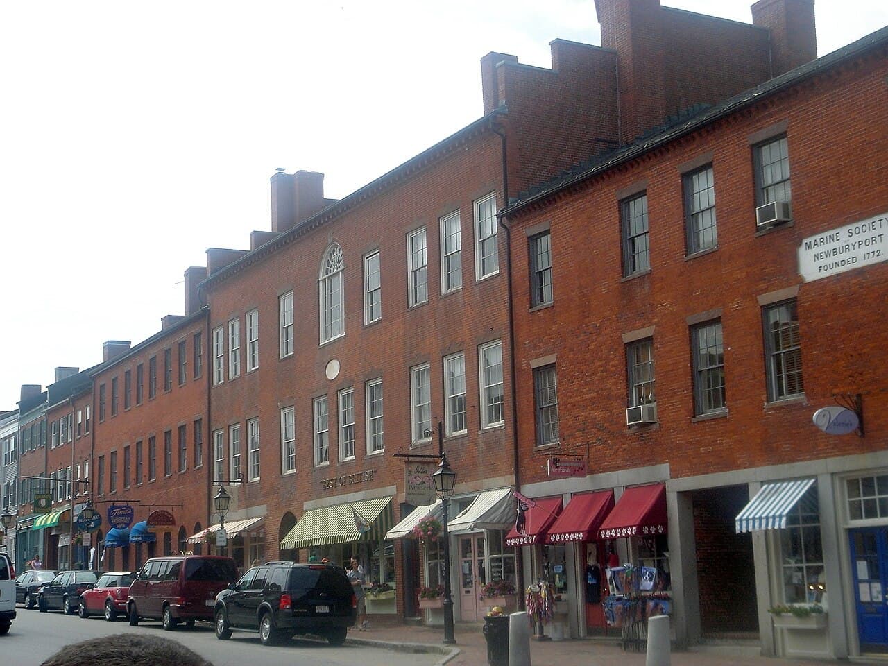
The mainland city whose downtown, harbor, and MBTA station sit just minutes across the causeway from the island's northern end.

Newbury
Holds the largest historical share of the island (2/5 under the 1649 grant) and the causeway approach via the Plum Island Turnpike.

Rowley
Holds the smallest share of the island (1/5) and shares Triton Regional schools with the Newbury section.

Ipswich
Holds the island's southern tip, including Sandy Point State Reservation, and its own town school system.
FAQ
Plum Island Real Estate — Frequently Asked Questions
What town is Plum Island actually in?
None, exclusively — Plum Island is an unincorporated barrier island whose land has been divided since a 1649 colonial land grant among Newbury, Ipswich, and Rowley, with Newburyport's 1851 incorporation adding a fourth municipality. Which town a given address is taxed and zoned by depends on exactly where it sits on the island.
What's the commute to Boston like?
By car it's roughly 45 miles / about an hour via I-95, traffic depending. The Newburyport MBTA station, reachable in about 10 minutes from the island, offers Commuter Rail service on the Newburyport/Rockport Line into Boston's North Station.
Is Plum Island at risk of flooding or erosion?
Yes. FEMA maps the island in VE (wave-action) and AE flood zones, and a December 2025 WBUR report found a 2015 Army Corps jetty repair accelerated erosion to as much as 53 feet a year in places. Massachusetts' ResilientCoasts Initiative has begun funding voluntary buyouts — one owner accepted a $1 million FEMA buyout in October 2025 — so flood insurance and elevation data are essential parts of any purchase here.
How walkable is the island?
Walkability is limited and very location-dependent: there are no sidewalks along most of the island's roads, and access on and off is via a single causeway. Within Plum Island Center on Northern Boulevard, a small cluster of shops, a restaurant, and beach access points are walkable to each other.
What's the price range for homes on Plum Island?
Recent Redfin data for the Newburyport-side Plum Island neighborhood has shown median sale prices ranging from roughly $1.1 million to $1.7 million across different 2025–2026 reporting windows — a reflection of a small, seasonal, and highly variable sales sample as much as a single fixed price point.
Is Plum Island on town water and sewer, or wells and septic?
It varies by lot. Some sections connect to municipal water, but many island homes rely on private wells and Title 5-regulated septic systems, which face added stress from salt intrusion and limited space for upgrades on a narrow barrier island. Confirming water/sewer status is a standard part of due diligence on any specific property.
What schools serve Plum Island?
It depends on which town's section of the island a property sits in: the Newburyport section is zoned to Newburyport Public Schools (Newburyport High School); the Newbury and Rowley sections feed into Triton Regional Middle and High Schools (shared with Salisbury), with their own town elementary schools; and the Ipswich section is zoned to Ipswich Public Schools (Ipswich High School).
Thinking About Life on Plum Island?
Because Plum Island crosses four different towns, buying or selling here means navigating four different tax rolls, zoning codes, and school districts — plus flood-zone and erosion questions no other Greater Newburyport community faces. Bentley's Real Estate works this barrier island section by section; reach out to talk through which stretch of the island fits what you're looking for.