
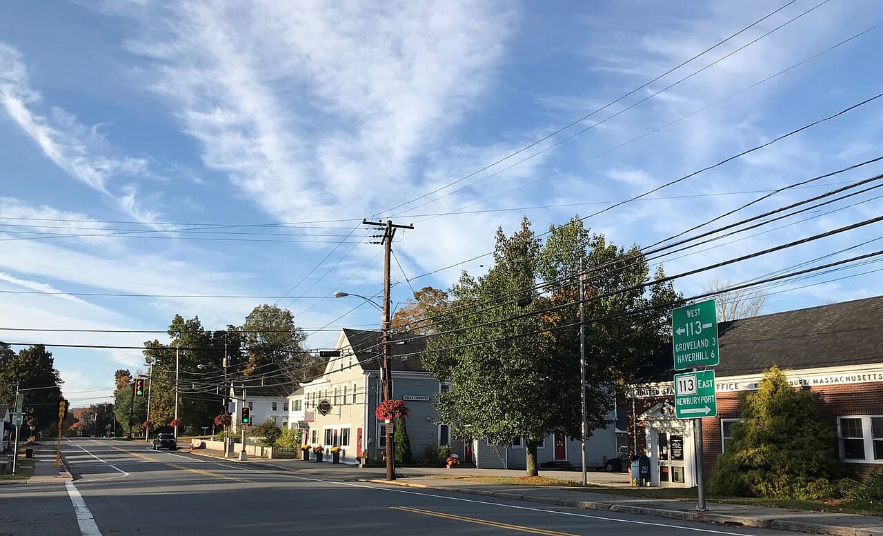
Essex County, Massachusetts
West Newbury Homes For Sale
MA
0
Population (2020 Census)
0
Year Incorporated
$0
Median Sale Price (Redfin, May 2026)
0 sq mi
Total Land Area
Location
Where West Newbury is Located
Live Listings
Homes For Sale in West Newbury, MA
Listing information is provided by the MLS. Information is deemed reliable but not guaranteed and should be independently verified. Listings displayed may be subject to prior sale or withdrawal.
A Local's Perspective
West Newbury, Massachusetts: Rural Character on the Merrimack
West Newbury was settled by English colonists in 1635 as an outlying farming district of Newbury, but it took nearly two centuries — and considerable resistance from the parent town — for it to become its own municipality. The Massachusetts General Court incorporated it on February 18, 1819, initially under the name "Parsons," before residents successfully petitioned to rename it West Newbury in 1820. Its earliest inhabitants were mostly farmers working the hilly land along the Merrimack River's south bank, a landscape defined by a string of named hills — Pipestave, Archelaus, Brake, Ilsey, Indian, Long, and Meetinghouse — that still shape the town today.
That agricultural identity never really faded. Long Hill Orchard, established in 1896, is still the town's oldest continually operating farm, and the West Newbury Riding & Driving Club keeps an equestrian tradition alive on Pipestave Hill. The riverside Rocks Village Historic District, at the western end of the 1905 Rocks Village Bridge to Haverhill, was listed on the National Register of Historic Places in 1976 for its dense cluster of 18th-century homes and its ties to poet John Greenleaf Whittier. The town's quiet, hill-and-farm character was even the reported inspiration for "Popperville" in Virginia Lee Burton's children's classic Mike Mulligan and His Steam Shovel.
Today West Newbury remains one of the least densely populated, most rural towns in the Greater Newburyport area — about 4,500 residents spread across roughly 14.7 square miles, with no town center of retail or commercial density to speak of. That scarcity of inventory, combined with sought-after Pentucket Regional schools and large-lot privacy within commuting range of both Newburyport and Boston, has kept prices firm: per Redfin, the median sale price in West Newbury was $1,059,366 in May 2026, up 11.5% year-over-year.
At a Glance
- Population
- 4,500 (2020 Census)
- Land Area
- 14.7 sq mi total (13.4 sq mi land)
- County
- Essex County, MA
- Property Tax Rate
- ~$11.07 per $1,000 assessed value (FY2024) — one of the lower rates in the region
- Walk Score
- 5–23 (Car-Dependent) — most errands require a car
Source-verified as of 2026-07-23.
Highlights
Why People Choose West Newbury

Rocks Village Historic District
A National Register district (listed 1976) of 18th-century homes at the West Newbury end of the 1905 Rocks Village Bridge over the Merrimack, tied to poet John Greenleaf Whittier.
Long Hill Orchard
Operating continuously since 1896, it's the town's oldest working farm — a working link to West Newbury's agricultural roots.
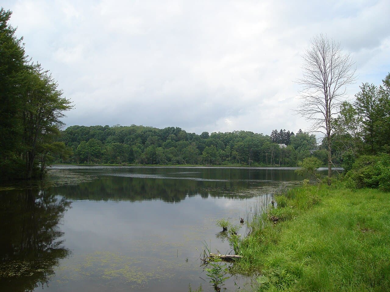
Pipestave Hill & Mill Pond Recreation Area
A roughly 270-acre network of trails, fields, and forest around Mill Pond, also home to Page Elementary School and a summer campsite.
Hills House Museum
An 1780s home run by the West Newbury Historical Society, preserving the town's colonial and agricultural history.

West Newbury Village Historic District
The town's small historic center along Main Street, with preserved 19th-century buildings reflecting its rural New England character.
Indian Hill Reservation
Conservation trails along the Merrimack River on land first purchased from Native inhabitants in the 1650s.
Neighborhoods
West Newbury's Neighborhoods & Villages

West Newbury Village / Main Street
The town's modest historic center, anchored by Town Hall and the West Newbury Village Historic District's 19th-century buildings — as close to a "downtown" as the town has.

Rocks Village
The riverside historic district clustered at the West Newbury end of the Rocks Village Bridge to Haverhill, with some of the town's oldest surviving homes.
Lifestyle
Life in West Newbury
West Newbury's lifestyle is defined by what it doesn't have as much as what it does: no downtown strip, no traffic, and very little turnover in its housing stock. What it offers instead is space, land, and a genuinely rural pace of life just a short drive from the coast.
Schools
Schools Serving West Newbury
Public Schools
Dr. John C. Page School (K–6)
Elementary
Pentucket Regional Middle School
Middle
Pentucket Regional High School
High
River Valley Charter School (Newburyport, elementary choice option)
Elementary (charter)
Private Schools
The Governor's Academy (Byfield/Newbury, ~10 minutes away)
Grades 9–12, boarding & day
School assignments are subject to change — always verify directly with the school district before making a decision. Source (verified 2026-07-23)
New Construction
Building in West Newbury
West Newbury has no active HOA-governed subdivisions or condo developments of note, and new construction is limited — but the town is in the middle of a closely watched rezoning process under the state's MBTA Communities Act.
MBTA Communities Section 3A Zoning District (in progress)
As an "adjacent small town" under the 2021 law, West Newbury must zone for at least 87 multi-family housing units. A first proposed overlay district at 187 Main Street failed at Town Meeting in April 2025; the Select Board restarted the process with a resident-input working group, and the town has yet to finalize a compliant district.
Nearby Communities
How West Newbury Compares

Newbury
Often confused with West Newbury despite being a separate town since 1819 — Newbury includes Plum Island and the Governor's Academy campus in its Byfield village.

Amesbury
A denser Merrimack-side city bordering West Newbury to the east, with a more walkable downtown and far more condo inventory.

Newburyport
The region's walkable harbor city, a roughly 12-minute drive away, offering the shopping, dining, and beach access West Newbury's rural setting doesn't.

Groveland
Shares the Pentucket Regional school district and a similar small-town Merrimack Valley feel just across the Haverhill-area line.
FAQ
West Newbury Real Estate — Frequently Asked Questions
What is the property tax rate in West Newbury, MA?
West Newbury's residential tax rate was about $11.07 per $1,000 of assessed value for FY2024, down from $13.01 the prior year as rising property values spread the tax levy — one of the more moderate rates among Essex County's Merrimack Valley towns. Confirm the current fiscal year's certified rate with the Town Assessor before relying on it for a purchase decision.
How long is the commute from West Newbury to Boston?
Boston is about 36 miles and roughly 40–45 minutes away by car under normal traffic, similar to the drive from neighboring Newburyport. There is no commuter rail stop in West Newbury itself; residents typically drive to stations in Haverhill or Newburyport.
Is West Newbury at risk of flooding?
West Newbury sits along the Merrimack River and participates in the National Flood Insurance Program, with a FEMA flood map most recently updated in 2025. Riverfront parcels near the Merrimack and Artichoke Rivers carry the town's main flood exposure; the hillier interior of town is generally not flood-prone. Check a specific property's FEMA flood zone before buying.
Is West Newbury walkable?
No — Walk Score rates most West Newbury addresses in the 5–23 (Car-Dependent) range, reflecting its rural, large-lot layout with no real commercial center. A vehicle is necessary for nearly all errands.
What's the price range for homes in West Newbury?
The market skews upscale for a small Essex County town: Redfin put the median sale price at $1,059,366 in May 2026, up 11.5% year-over-year, reflecting the town's large lots and low inventory.
Does West Newbury have public water and sewer?
Only partially. The town operates a limited municipal water system serving some areas (with periodic usage restrictions tied to well levels), but there is no town-wide sewer system — most homes rely on private septic systems, and some also use private wells.
What schools serve West Newbury?
West Newbury is part of the Pentucket Regional School District, shared with Groveland and Merrimac. Elementary students attend Dr. John C. Page School (K–6) in town, or may opt into River Valley Charter School in Newburyport, before moving on to Pentucket Regional Middle and High Schools. The Governor's Academy, a private boarding/day school, is about 10 minutes away in Byfield.
Ready to Explore West Newbury Real Estate?
From riverside historic homes near Rocks Village to large-acreage properties on Pipestave Hill and Indian Hill, West Newbury offers some of the most private, land-rich living in the Greater Newburyport area. Connect with Bentley's Real Estate to see current listings and get local market guidance for this small, close-knit town.